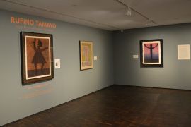
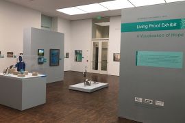
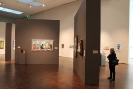
Marking Territory: Cartographic Treasures of the Mississippi River and the World Beyond
March 1, 2013 - June 15, 2013
About
Marking Territory: Cartographic Treasures of the Mississippi River and the World Beyond
Marking Territory: Cartographic Treasures of the Mississippi River and the World Beyond is a special exhibition organized by the Figge Art Museum. Featuring a selection of historic maps that range from early representations of the world to more detailed examinations of America’s vast interior west of the Mississippi, the exhibition explores how maps communicate highly complex ideas about identity, politics and culture. Maps should be understood not as mere way-finding tools and neutral transmitters of an objective reality but as representations of specific points of view. They recreate and construct realities by controlling the information they provide, that is, their makers made choices on which aspect of reality they wished to show while ignoring others.
American identity coincided with the evolution of maps. From the late 17th through the 19th centuries, cartographers and explorers recorded what they were learning about the US interior west of the Mississippi. Never innocent of broader political objectives, these maps of the New World function as exercises in power, attempts on the part of one nation and race to exert control over another. The shifting boundaries of Iowa in the 19th century, for example, demonstrate the American government’s interest in solidifying borders and publically laying claim on territories. Maps frequently represent the presence of native people such as the Fox (Meskwaki), Sauk, and Ioway but not their rights to the land. Vignettes on the margins of the maps included scantily clad, buffalo-hunting “savages” that reinforced the message that white European settlers were the divinely-sanctioned rulers of the land. As such, maps in this exhibition give visual and persuasive form to the idea of Manifest Destiny that prompted westward expansion. In documenting the fluidity and continuity between territories, maps suggest that the West is capable of being traversed and thus inhabited, conquered and exploited.
Informed by political agendas and underlying values, maps function as important historical and cultural documents that offer a compelling look into the past. They remind the exhibition viewer to look for what is not only present in an image but also what has been hidden from view. In the case of maps of the American interior, it is the voice of the Native American that has been relegated to the margins.
Interview with Map Collector H. Dee Hoover
A When I was about 7 or 8 years old.
Q What fascinates you about them?
A Many things. When I was young, I looked at maps as a way to transport myself to that place. I was able to visualize myself being anywhere in the world. As I got older, I especially appreciated maps from the 16th, 17th and 18th century due to the fact they were so spectacularly beautiful.
Q Which is the first map that you acquired?
A The Abraham Ortelius map of the world was the first map I acquired that relates to the Marking Territory exhibition. This map is the 1570 world map that was the centerpiece of the first real atlas.
Q What would you hope our visitors would learn from your collection?
A I think people will learn about historical information that sometimes only shows up in maps or is difficult to access elsewhere. Maps of the Midwest, the Mississippi River and of Iowa provide a visualization of areas that people may not know about, so a natural dialogue amongst viewers of the maps should ensue.
Q What does it mean to you to have maps from your collection on display at the Figge?
A It’s an honor to have the maps on display, and I’m delighted to give people the opportunity to see them. Many of these maps are rare, and it’s my hope visitors will develop an appreciation of the artistic nature of the maps and enjoy them as much as I do.
Q How many maps do you have in your collection?
A I probably have fewer than 50 antique maps and atlases. I try to be selective about what I buy, since I want to be able to display them. We only have so much wall space.
This exhibition is on display March 2-June 16, 2013.
Download the gallery guide for the exhibition.
Sponsored by
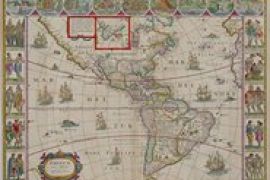
images: (above) Willem Blaeu, Americae Nova Tabula, 1617/1635, hand-colored copperplate engraving, H. Dee and Myrene Hoover Collection; Sebastian Munster, Die Neüwen Inseln, 1540/1572, hand-colored woodcut,, H.D. and Myrene Hoover Collection